Skip to content

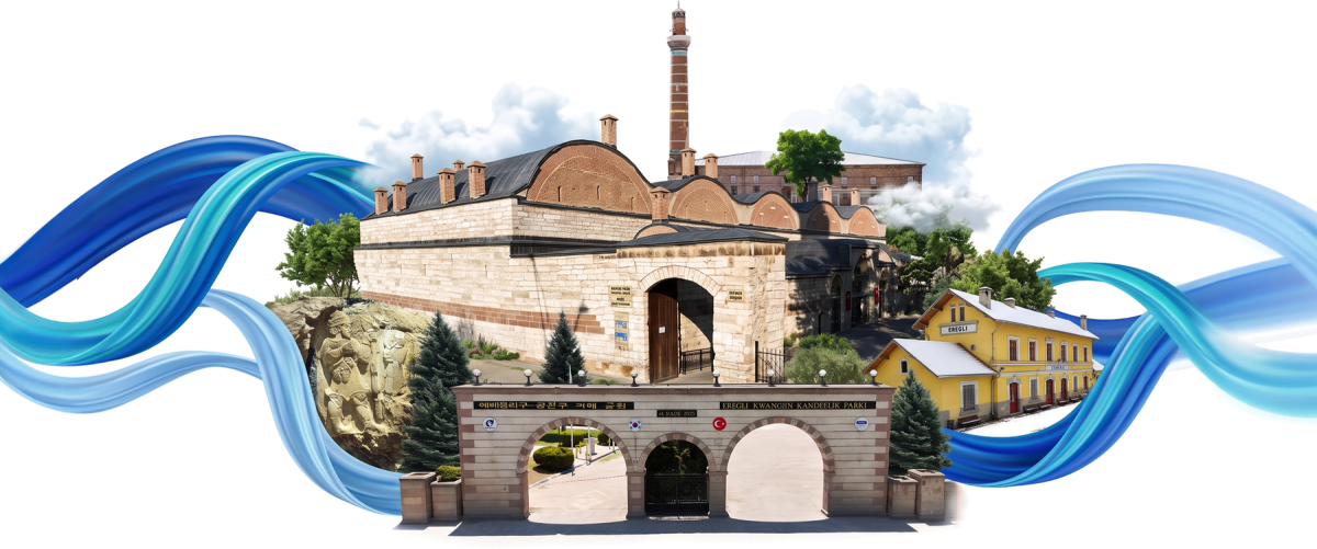
Ereğli History and Culture Guide

The History and Culture Guide

Tarih ve Kültür Rehberi

Discover Ereğli's monuments, natural wonders, local produce and flavours, with locations you can open on the map.

Download the guide PDF · 9,9 MB
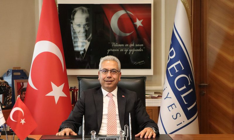
Umut Akpınar
Umut Akpınar Mayor

Shaped by its fertile lands and rich water resources at the foot of the Taurus Mountains, Ereğli is one of the prominent districts of Konya with its deep-rooted history, natural beauties, and cultural heritage. Known as "Green Ereğli", the district has hosted many civilizations from the Hittites to the present day. Situated at the center of intercontinental trade networks, our city has been one of the most strategic caravan routes of the historical Silk Road.

The İvriz Rock Relief and the Akgöl wetland in the south are among the most significant examples of our city's historical and natural richness. The historical railway line passing through our city has served as a geopolitical bridge both in the transportation of industrial raw materials and in urban development. With its fertile agricultural lands, horse breeding, and strategic location on transportation networks, Ereğli holds great regional potential.

Advancing confidently into the future with its historical heritage, natural beauties, and contemporary vision, this guide introducing Ereğli aims to be a roadmap for all visitors.

Historical Geography

Tarihi Coğrafya

The name Ereğli originates from the ancient city of Herakleia and derives from the Greek mythological hero Heracles (Hercules). Over time, the name evolved through the forms Herakle > Irakle > Eregle > Ereğli. According to the 17th-century traveler Evliya Çelebi, the place was named "Erkili" after the soldiers of Alaaddin Keykubat healed their wounds with its therapeutic mud.

Thanks to its rich water resources and fertile lands, Ereğli has been continuously inhabited from the Neolithic Age to the Ottoman period. Located between Central Anatolia and the fertile plains of Çukurova, it has served as a vital crossroads throughout history. After the fall of the Hittites, the Kingdom of Tuwana (1200–742 BC) ruled here, leaving behind the famous İvriz Rock Relief. The city later came under Assyrian, Roman, and Byzantine rule, was targeted by Arab raids, and served as a military base during the Byzantine era. Throughout its long history, Ereğli has remained a significant hub for trade, agriculture, and culture — a living reflection of Anatolia's ancient legacy.
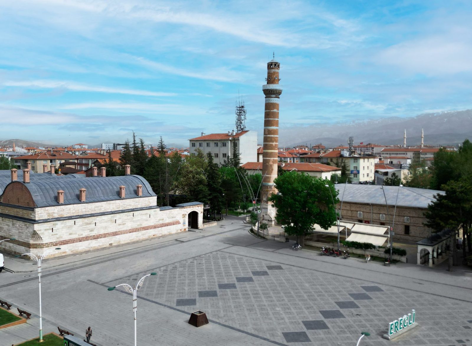
Ereğli came under Anatolian Seljuk rule in 1077, six years after the Battle of Manzikert, during the reign of Süleyman Shah, son of Kutalmış. In 1276, the city became part of the Karamanoğlu territories after Mehmet Bey made Konya the capital. Ereğli came under Ottoman rule in 1398 and, after changing hands between the two powers for a period, remained continuously under Ottoman rule from 1457 onward. Important historical structures that have survived from these periods include the Ulu Mosque, Rüstem Pasha Caravanserai, Cağaloğlu Bedesten and Şifa Bathhouse.

During the Turkish War of Independence, the French planned to occupy Ereğli after taking control of Adana and its surrounding areas. Their plans were uncovered through a letter intercepted at the Ereğli post office. Colonel Rüştü Bey, commander of the 126th Regiment in Niğde, organized the National Forces (Kuva-yi Milliye) in Ereğli and prevented the French from occupying the city.
Following the Turkish War of Independence, Ereğli became a district of Konya Province. Its historical heritage from the Seljuk, Karamanoğlu and Ottoman periods, together with its role during the National Struggle, forms an important part of the city's historical identity.
Cultural Values

Kültür Varlıklarımız

Ulu Mosque

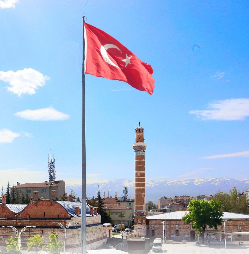
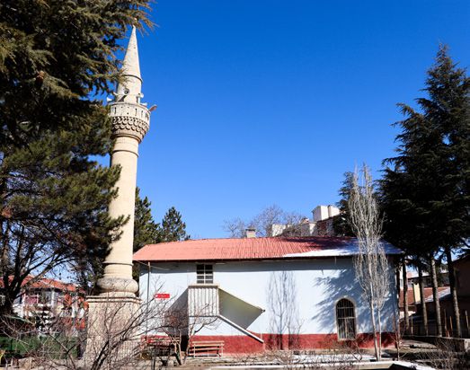
Located in the Cami Kebir neighborhood, the Ulu Mosque was commissioned in 1426 by Mehmet Bey of the Karamanids. It is one of the most significant cultural landmarks of Ereğli. The mosque features a kufa-type plan, with a flat roof supported by eight rows of arches extending north to south. The arches rest upon 32 columns, eight of which are masonry-built while the rest are made of repurposed (spolia) materials. Twenty-four of the columns and capitals date back to the Roman and Byzantine periods, reflecting the blend of architectural heritage within the structure.

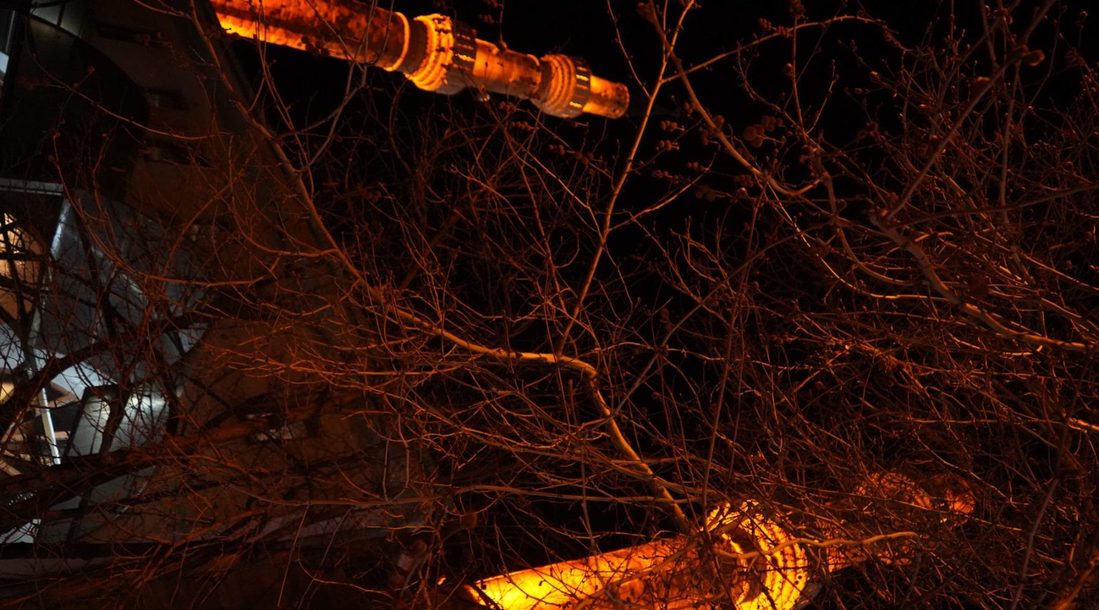
Restoration inscriptions located near the minaret entrance indicate that the mosque has undergone several repairs. The mihrab (prayer niche) was rebuilt during restoration works in 1940. The minaret, standing 40 meters tall, is made of red cut stone and adorned with white stone bands and tile-mosaic decorations. These stylistic elements are characteristic of Seljuk architectural tradition.

Open in Maps

Cağaloğlu Bedesten

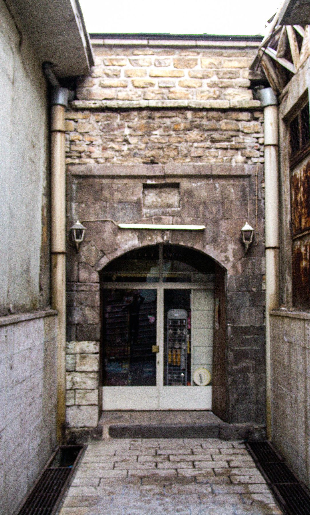
Cağaloğlu Bedesten is one of Ereğli's important historical commercial structures, preserved from the Ottoman period within the city's traditional marketplace. Located west of the Ulu Mosque, around Uzun Çarşı, the building is associated with the foundation established by Cağalzâde (Cigalzâde) Sinan Pasha and is dated to 1605 in current sources. The rectangular structure extends along an east-west axis and was built using rubble stone, cut stone and brick, with a barrel-vaulted roof.

Bedestens were important centers of commercial life in Ottoman cities, serving as secure marketplaces where valuable goods and various commercial products were traded. Cağaloğlu Bedesten played an important role in Ereğli's historical commercial life and contributed to the development of the traditional marketplace together with the shops surrounding it.

Preserved through various restoration works, the building remains an important part of Ereğli's cultural heritage, reflecting the city's Ottoman-era commercial history through its architectural character, historical function and central location.

Open in Maps

Rüstem Pasha Caravanserai

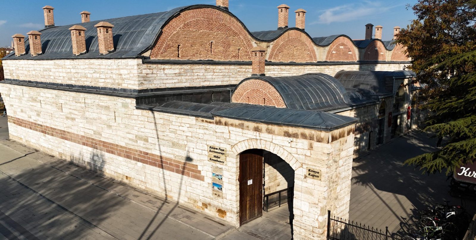
The Rüstem Pasha Caravanserai was commissioned in 1552 by Grand Vizier Rüstem Pasha during the reign of Sultan Süleyman the Magnificent and was designed by Mimar Sinan. It stands as one of the few well-preserved examples of classical Ottoman caravanserais. Although some sources describe it as "the only surviving one among five way-stations," this claim is not fully verified. A more precise description would be that it is one of the most notable examples of its period.

The building features a three-stage plan, consisting of a low entrance iwan, narrower side iwans, and sets of three rooms, each equipped with a fireplace. Its large stable section is a spacious hall supported by four central piers. The barrel-vaulted roof is pierced by slit windows, providing light and ventilation. This architectural layout demonstrates that the caravanserai was carefully designed to accommodate both travelers and their animals comfortably.

Open in Maps

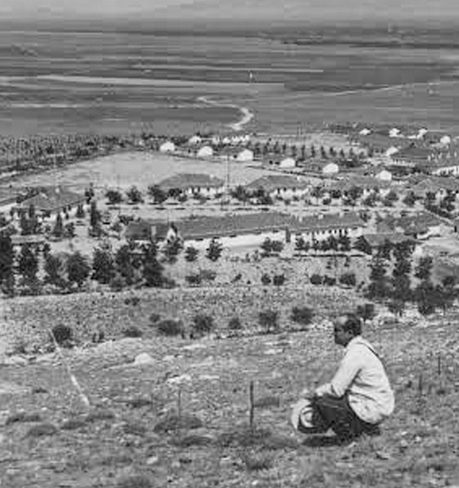
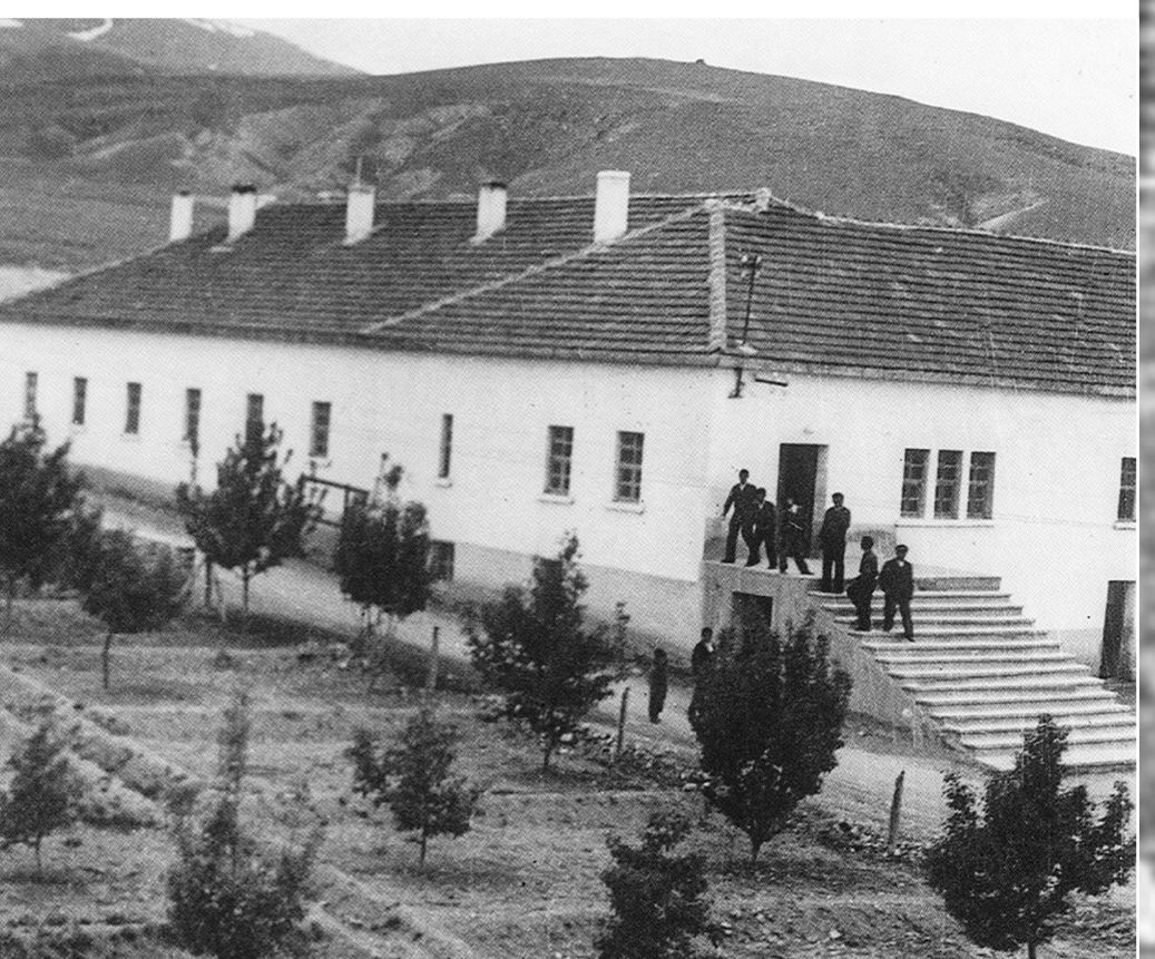
İvriz Village Institute

İvriz Village Institute was established on November 11, 1941, as one of the important educational centers of the Early Republican Period's rural development initiative. Guided by the educational philosophy of "learning through work and for work," promoted by Minister of National Education Hasan Âli Yücel and Director General of Primary Education İsmail Hakkı Tonguç, the institute holds an important place in the educational history of Ereğli and the surrounding region.

Located on a large site around Gaybi, Durlaz and Dedeköy, chosen for its proximity to the railway, fertile agricultural land and abundant water resources, the institute functioned not only as a teacher-training school but also as a center for production and rural development. Beginning its educational activities with 475 scholarship-supported boarding students, the school provided practical training in agriculture, animal husbandry, carpentry, metalworking and construction. Students also took an active role in building the school's facilities, workshops and production units.

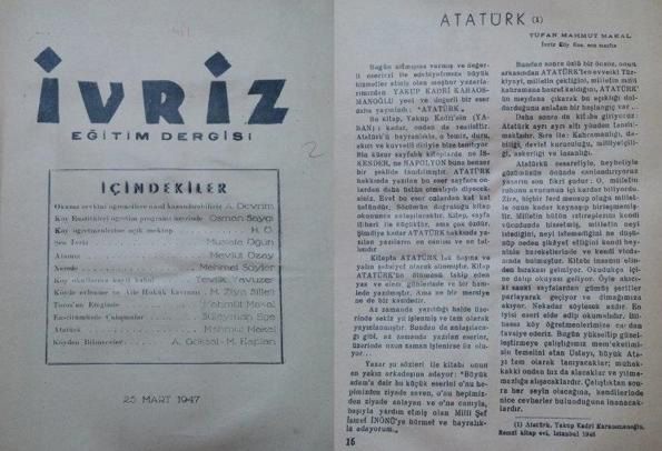
The institute placed equal importance on culture and the arts. In 1947, it began publishing the "İvriz" journal, contributing to the educational and cultural life of its time. Between 1942 and 1954, the institute trained hundreds of teachers before later being transformed into a teacher-training school and eventually a teacher high school.

Bringing education, production, culture and social development together under one roof, İvriz Village Institute remains one of the most significant educational heritage sites of Ereğli's Republican-era history, preserving its important place in the collective memory of the city.

Open in Maps

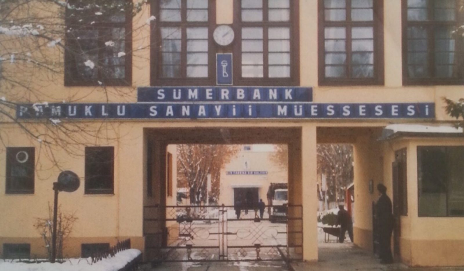
Sümerbank Cloth Factory

The Sümerbank Ereğli Cloth Factory is one of the most important symbols of Ereğli's industrial history. Built in line with Gazi Mustafa Kemal Atatürk's vision that "Every factory is a fortress," the factory was opened on April 4, 1937, as a collective achievement of Turkish engineers.

Processing Anatolian cotton, the factory brought spinning, weaving and garment production together under one roof and made a significant contribution to the country's textile industry with fabrics such as marmerşahi, calico and salaşpur. With its housing facilities, nursery, cinema and social spaces, it was more than a production facility; it also served as a "social factory" model that contributed to the economic and social development of Ereğli.

Open in Maps
Şeyh Şıhabüddin Mausoleum

Şeyh Şıhabüddin Mausoleum

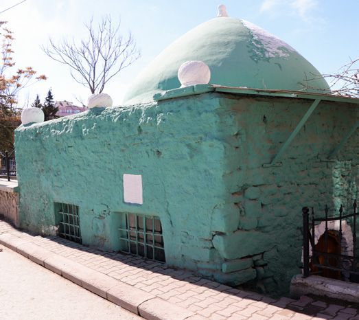
Built in the 13th century, this sarcophagus-shaped tomb bears Seljuk thuluth inscriptions featuring prophetic sayings. It was later restored during the Karamanid period. One of the inscriptions reads:

"Die before you die; believers do not die, but pass from one abode to another."

Open in Maps
Ahi Zekeriya Mausoleum

Ahi Zekeriya Mausoleum

Located beside Meydanbaşı Cemetery, this mausoleum is made of plain stone. Its marble sarcophagus bears an inscription in elegant thuluth script, reading:

"Verses from Ayetel Kürsi and the Declaration of Faith… Here lies the sainted martyr, Ahi Zekeriya Helva-i. May Allah illuminate his grave."

Open in Maps
Ebu'd Derda Mausoleum

Ebu'd Derda Mausoleum

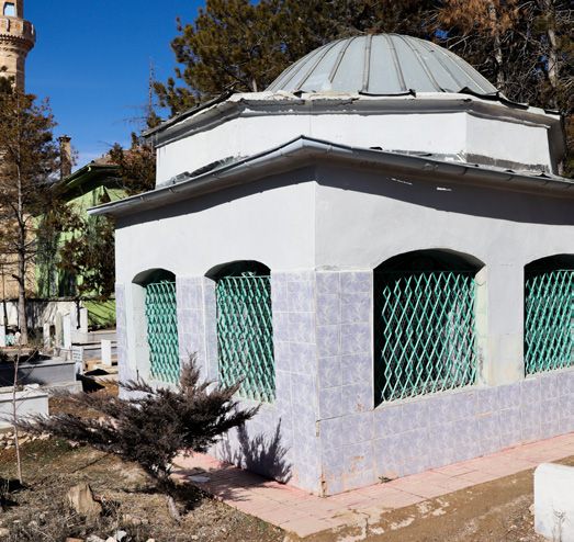
The Tomb of Ebu'd Derda is situated within the Ebu'd Derda Cemetery. Its dome, resting on an octagonal drum set over a square base, reflects the characteristic style of the period. The structure was built using cut stone.

This mausoleum in Ereğli symbolizes the spiritual legacy of Ebu'd Derda in Anatolia. With its quiet and tranquil atmosphere, it offers visitors both historical and spiritual depth.

Open in Maps
Mustafa Bey Mausoleum

Mustafa Bey Mausoleum

Located in the Alparslan neighborhood, this square-plan domed tomb was built in 1710 for Mustafa Bey, the four-year-old son of Grand Admiral Aşçı İbrahim Pasha.

The gravestone bears a poem by Ahmet Durdi Efendi. Sixty-nine years later, Ematullah Hanım, wife of Çelebi-zâde İsmail Asım Efendi, was also buried here.

Open in Maps

Şifa Bathhouse

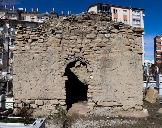
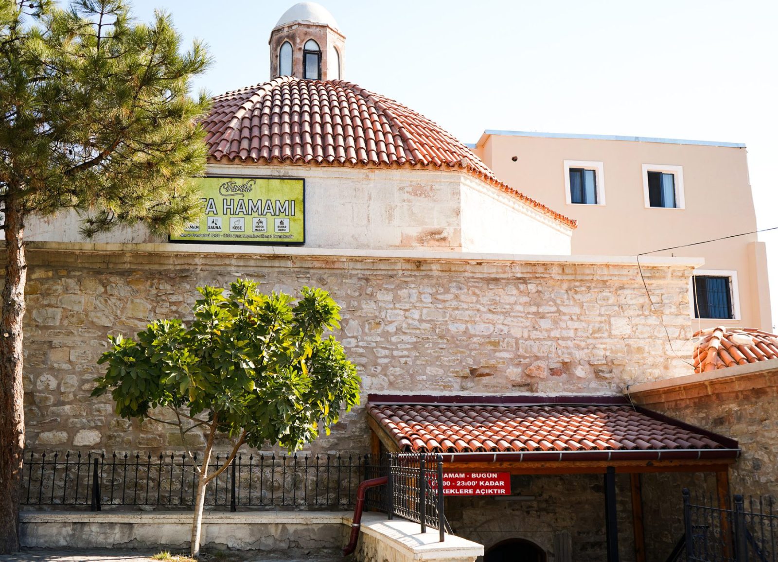
Located in the Cami Kebir neighborhood, the Şifa Bathhouse dates back to the Ottoman period. Although it bears no construction inscription, some researchers suggest that it may have origins in the Karamanid era. A section of its dome has collapsed over time and was later covered with a wooden roof. The entrance to the bath is from the west, accessible by ten steps. The interior consists of three main sections — changing room, warm room, and hot room, arranged in the traditional three-iwan layout of Turkish baths. The hot section contains four iwans, with domed chambers between them.

Open in Maps

Ereğli Museum

The name of Ereğli originates from the ancient city of Heracleia and the mythological hero Heracles, while its history traces back to the Neolithic Age. The idea of founding a museum emerged in the 1960s, and the current building opened in 1968. Until 1977, it was affiliated with the Konya Museum; in 1978, it became an independent directorate. A storage annex was added in 1980.

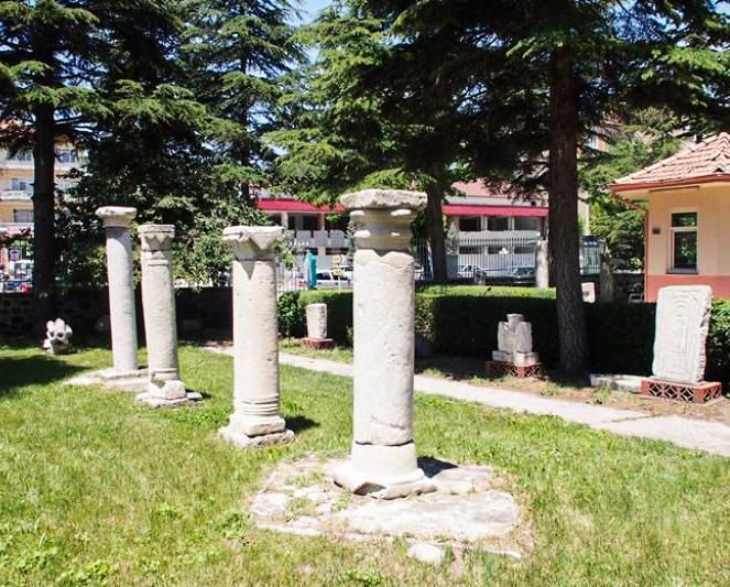
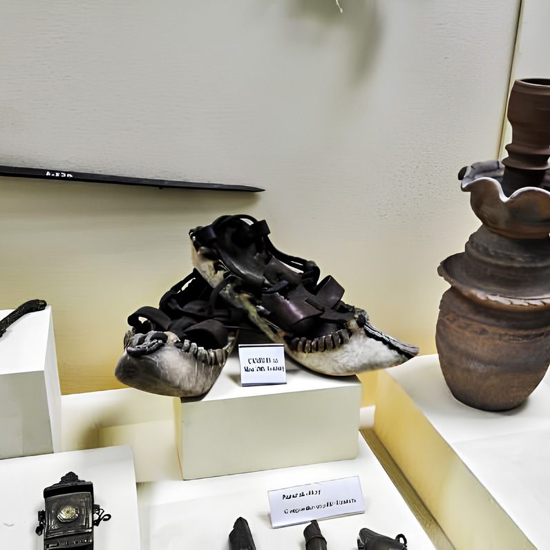
The Ereğli Museum is one of the few museums in Anatolia presenting a continuous collection from the Neolithic to the Republican era. The exhibits include Neolithic findings from Can Hasan, Chalcolithic pottery, Early Bronze Age figurines and seals, Assyrian Trade Colonies period pitchers, Hittite terracotta works, Phrygian fibulae, coins from the Heracleia Hoard (Hellenistic period), Roman architectural fragments and stelae, Byzantine golden christograms, glazed bowls and decorations from the Seljuk and Karamanid periods, and Ottoman artifacts such as an illuminated Qur'an, bridal chest, weapons, carpets, and kilims.

Among its rarest pieces are a mammoth fossil discovered in the Zengen sandpit and gilded wooden sarcophagus fragments from the Göztepe Tumulus.

Open in Maps
Boys and Girls Monastery

Boys and Girls Monastery

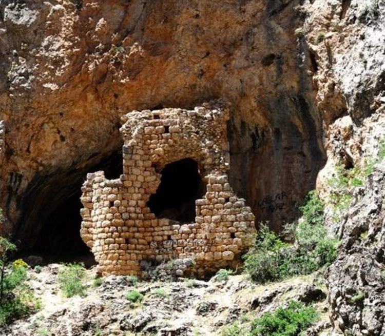
Located within the Ambar Stream valley in İvriz Neighborhood, this multi-storey monastery was constructed at the mouth of a natural cave using finely cut stone. The workmanship is of high quality, and the building dates to the Early Byzantine Period. It was built for religious education, serving as a mixed monastery where both male and female students were trained.

Open in Maps
İvriz Fortress

İvriz Fortress

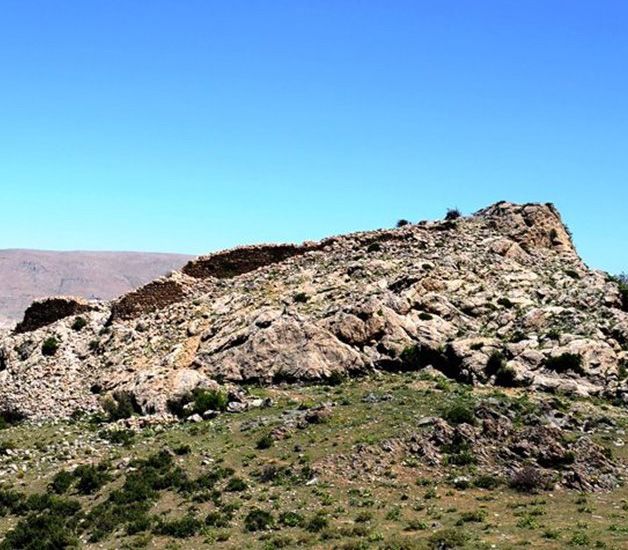
The İvriz Fortress is located on a hill overlooking the İvriz Neighborhood. Remnants of fortification walls inside and around the site indicate that it was used during the Hittite and Medieval periods.

Open in Maps
Kale-i Mindos (Kayasaray)

Kale-i Mindos (Kayasaray)

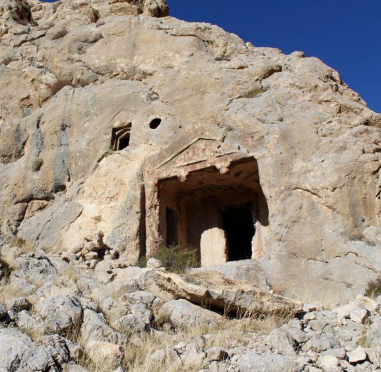
Located on a steep hill south of Kale Village, Kale-i Mindos features Iron Age wall remains and retained its strategic importance until the Ottoman period. At its center lies a cistern and traces of a later windmill. The site also includes Roman rock-cut tombs decorated with columns, triangular pediments, and klinai (stone couches). Owing to its position along an ancient route leading to the Mediterranean, it served as an important settlement throughout history.

Open in Maps
İvriz Bridge

İvriz Bridge

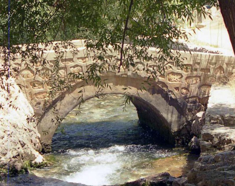
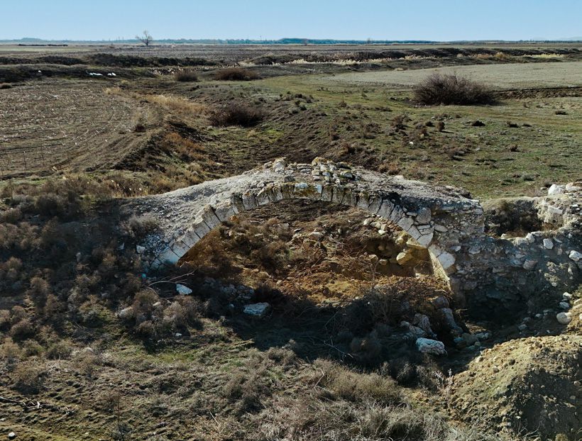
Located over the İvriz Stream along the old caravan route, this Ottoman-era bridge is constructed of finely cut stone. The route connects Ereğli to Horozlu Han in Tarsus.

Open in Maps
Hortu (Sazgeçit) Bridge

Hortu (Sazgeçit) Bridge

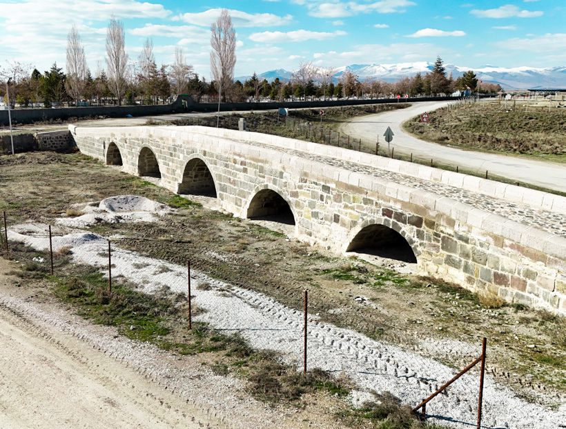
Situated in the Sazgeçit Neighborhood, this five-arched bridge was built of cut stone to ensure safe passage during the seasonal floods of Akgöl in spring. It lies on the old Aksaray–Ereğli caravan route and dates to the Karamanid period. The bridge remains in use today.

Open in Maps
Akhüyük Bridge

Akhüyük Bridge

Located on the Akhüyük–Çiller Village road, this single-arched bridge features a cut-stone exterior and rubble-stone interior. It lies along the old Aksaray–Ereğli route and dates to the Ottoman period.

Open in Maps

Natural Assets

Tabiat Varlıklarımız

Akgöl

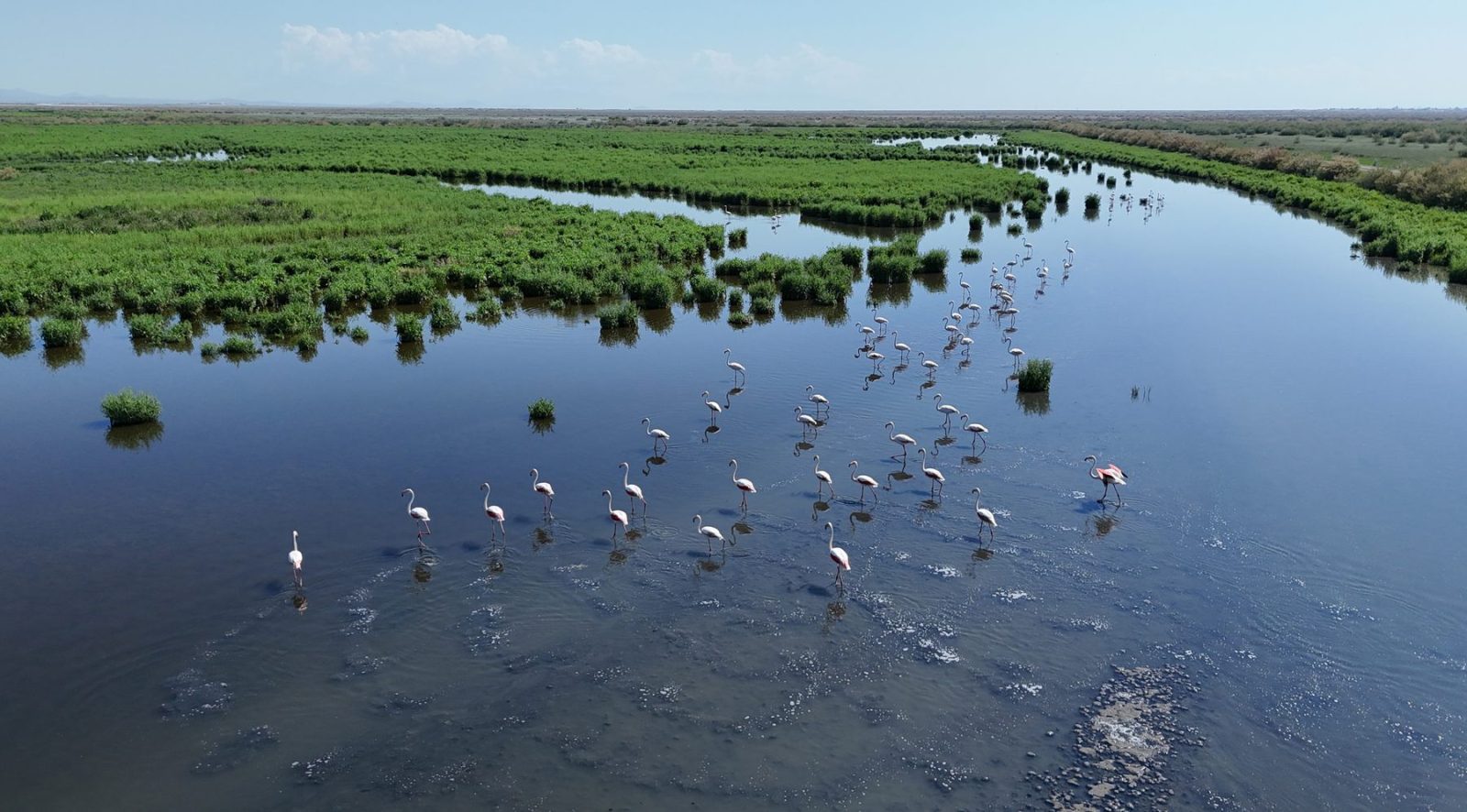
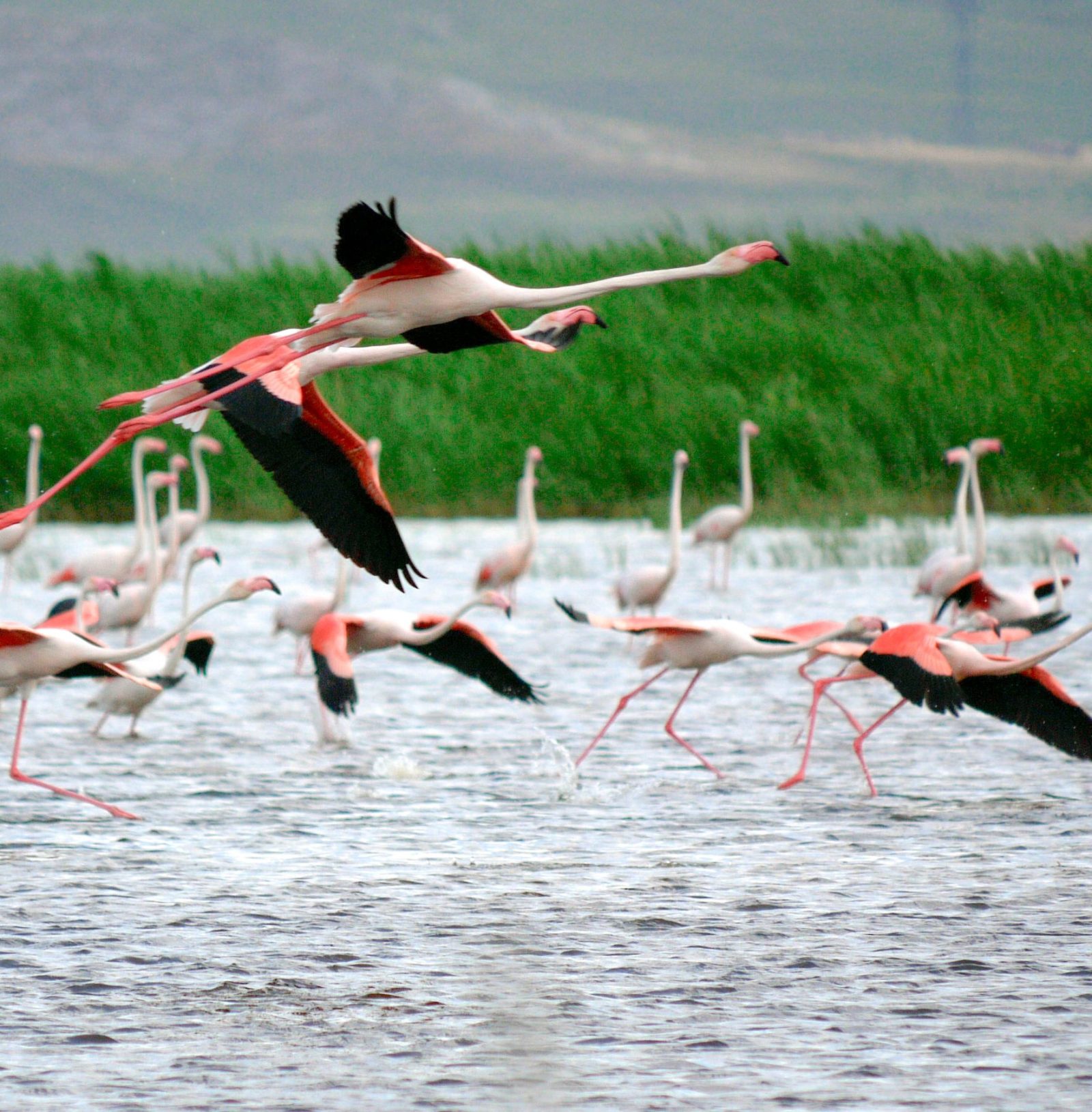
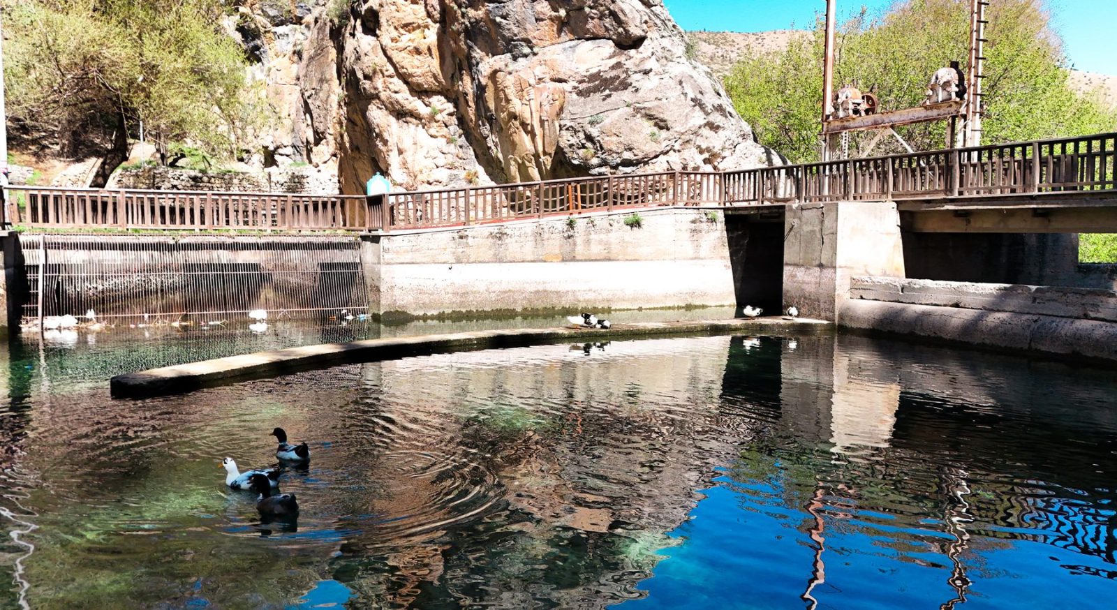
Located 30 km west of Ereğli's town center, Akgöl Wetlands cover an area of approximately 6,400 hectares, consisting of reed beds, marshes, freshwater lakes, and saline steppes. The site serves as a vital stopover for migratory birds, including flamingos, pelicans, herons, mallards, cranes, shelducks, and geese. With its rich biodiversity and unique ecosystem, Akgöl is one of Ereğli's most valuable natural habitats, providing opportunities for scientific research and eco-tourism.

Open in Maps

Akhüyük (Sulfur Water Supply)

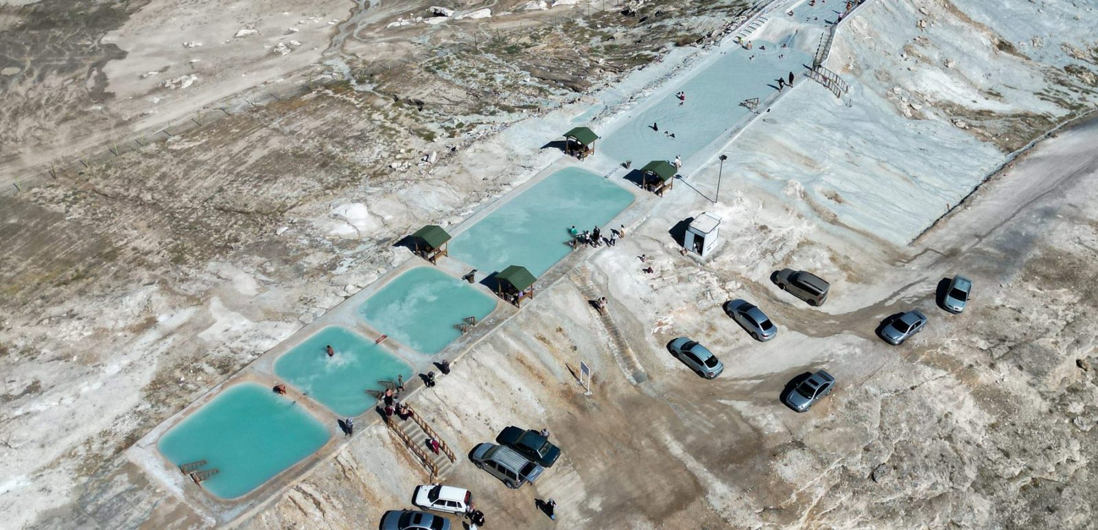
Akhüyük, featuring high geothermal resources and sulfur-rich travertines, is utilized among the public for the treatment of skin diseases. Alongside the ancient name "Herakleia", our city's name is also identified with a deep-rooted legend mentioned in Evliya Çelebi's Book of Travels (Seyahatname). According to the narrative, the wounded soldiers of Sultan Alaaddin Keykubad I were healed by this sulfurous mud; consequently, the Sultan named the place "Erkili", meaning the mud of the brave.

Open in Maps

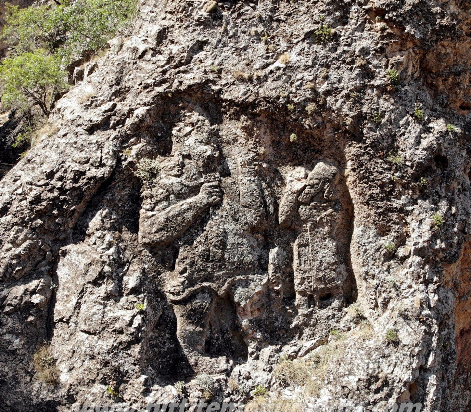
İvriz Rock Relief

The İvriz Rock Relief (Hittite Relief) is located in İvriz Village, part of Halkapınar District, about 17 km southeast of Ereğli. Carved into a rocky surface near the source of the İvriz Stream, it dates back to the Late Hittite Period (1180–700 BC). Commissioned by King Warpalawas of Tuwana, it was introduced to the academic world in the 19th century through the records of European travelers.

Measuring 4.2 × 2.4 meters, it is one of the most remarkable examples of Late Hittite art. The relief depicts the Storm God Tarhunzas and King Warpalawas of Tuwana. The god, shown on a larger scale than the king, holds ears of corn and grape clusters, emphasizing his role as a deity of fertility and abundance. The king is portrayed facing him in a posture of prayer.

The Luwian hieroglyphic inscription reads: "When I was a prince in the palace, I planted these vines. May Tarhundas grant them fertility and abundance." A simpler variant of this monument exists nearby, in the Ambar Stream area.

Open in Maps

Atatürk Cultural Park

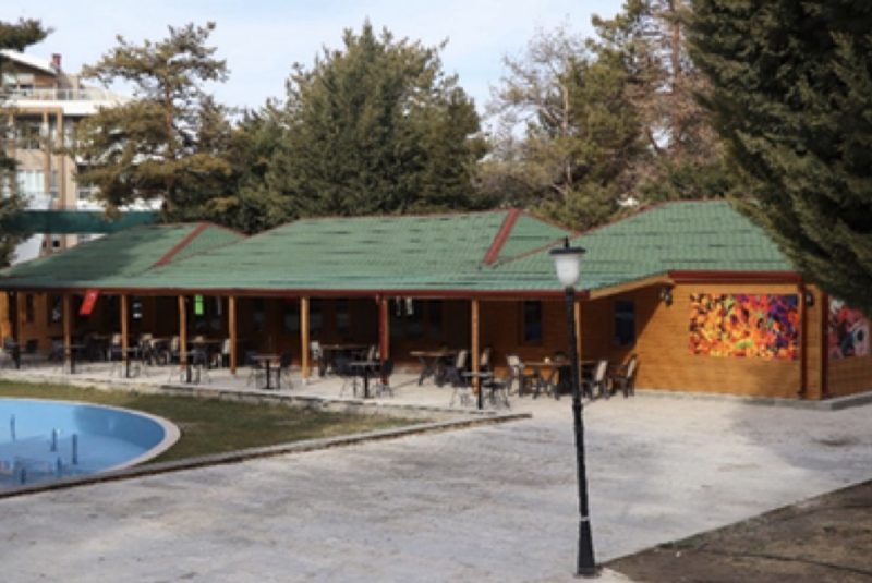
Atatürk Cultural Park, popularly known as Regulator, is one of Ereğli's prominent green spaces and social gathering areas. With its extensive recreational facilities and amphitheatre, it was one of the largest open-air park projects in Türkiye at the time of its opening.

The park dates back to tree-planting efforts initiated in 1991. Featuring a swimming pool, amphitheatre, sports facilities, picnic areas, walking paths and resting spots, it offers visitors of all ages the opportunity to spend time surrounded by nature.

Today, the park is undergoing an extensive restoration and renewal process. Its landscaping is being revitalized, while the amphitheatre and social areas are being modernized. With its renewed infrastructure and recreational facilities, Atatürk Cultural Park continues to be one of Ereğli's important leisure and recreation destinations.

Open in Maps

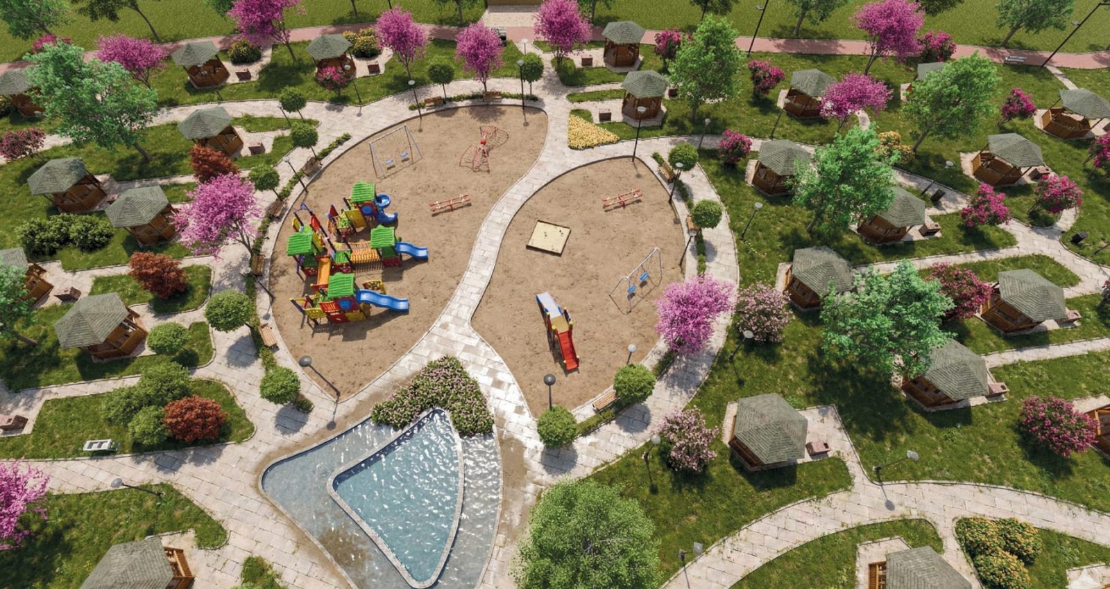
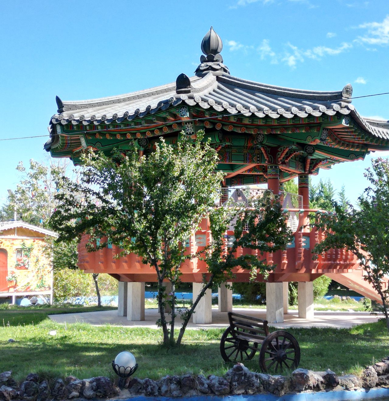
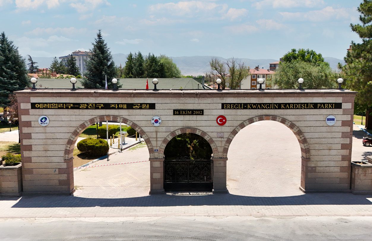
Gwangjin Friendship Park

Gwangjin Friendship Park is one of the important cultural spaces symbolizing the long-standing friendship between Türkiye and South Korea. Established as part of the sister-city relationship, the park was opened on October 16, 2002. Its entrance gate and pavilion, inspired by traditional Korean architecture, give the park a distinctive cultural character.

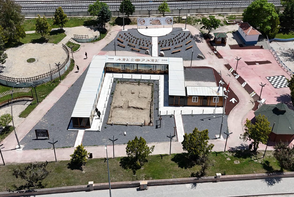
With its spacious walking paths, children's playgrounds and green recreational areas, the park provides a peaceful setting for residents. The park also features an Archaeopark, offering an interactive cultural experience through archaeological excavation simulations and ancient-themed workshops, allowing children to discover and learn about history firsthand.

Open in Maps

Economic Structure

Ekonomik Yapı

Agriculture

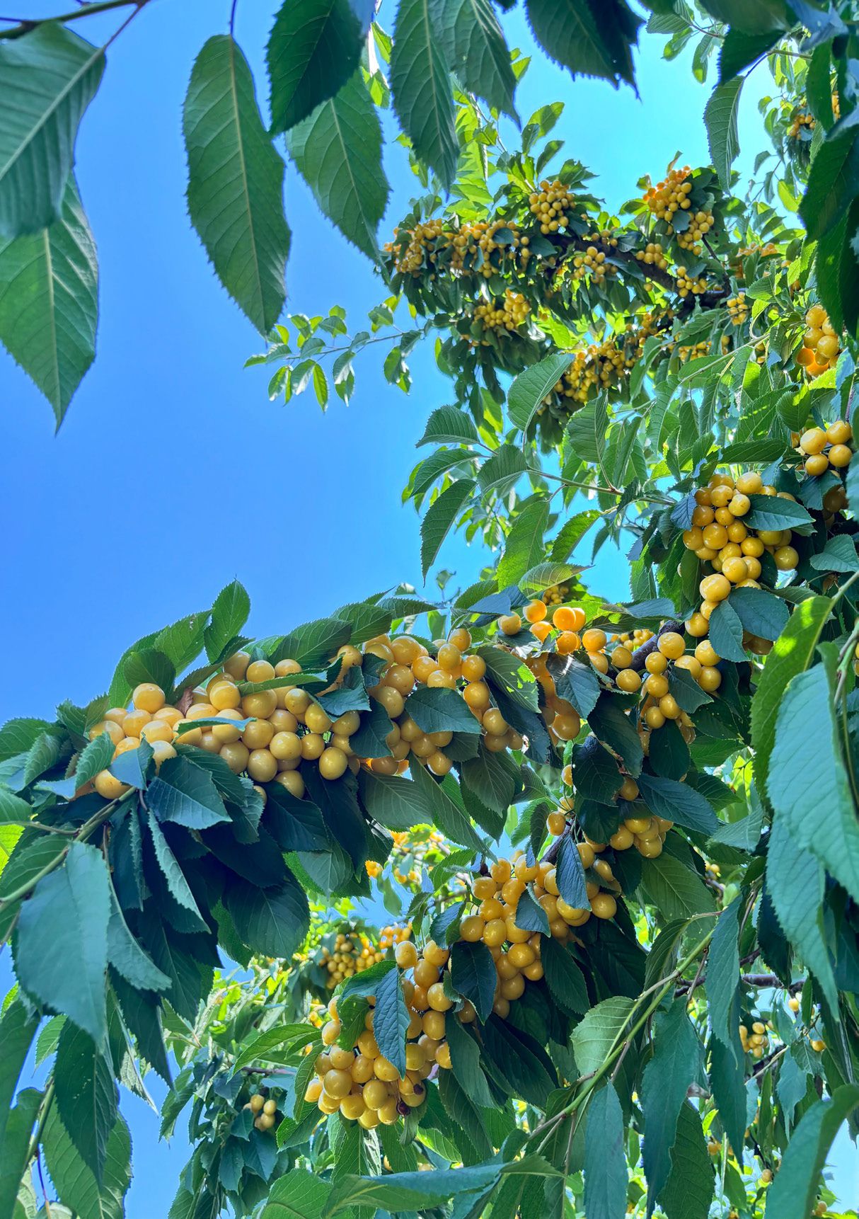
Ereğli's economy relies primarily on agriculture, employing over 52% of its population. Main crops include grains, legumes, industrial plants, fruits, vegetables, and forage crops. Among them, cherry and black carrot exports significantly contribute to the district's economy.

With modern farming practices and a closed-loop irrigation project, agricultural productivity in Ereğli is steadily improving.

Animal Farming

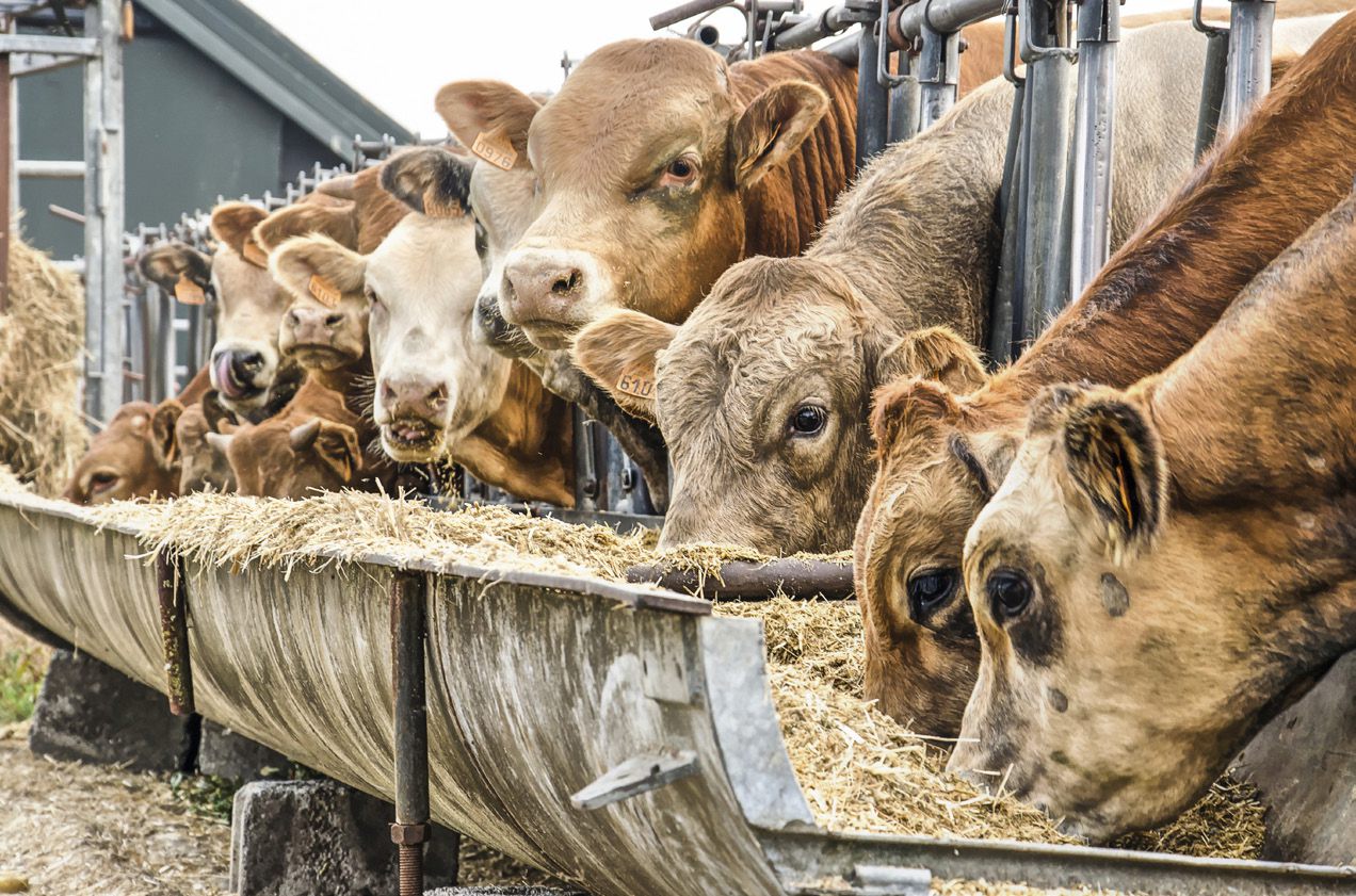
Livestock farming in Ereğli is as significant an economic activity as agriculture, with both fattening and dairy cattle breeding well established. Today, Ereğli is one of the leading centers for animal husbandry in Konya and the surrounding region. The district is home to approximately 130,000 cattle and 150,000 small ruminants. More than 800 tons of milk are processed daily, and with over 20 modern facilities, Ereğli has become one of Turkey's foremost centers for milk and dairy product production.

Milk and Dairy Products

Ereğli is one of the most important livestock centers of Konya and its region. The district has approximately 130,000 cattle and 150,000 sheep and goats, with more than 800 tons of milk processed daily. Thanks to over 20 modern facilities, Ereğli has become one of Turkey's leading centers in milk and dairy production. With the continuous increase of farms and factories, the sector is expanding, and Ereğli makes a strong contribution to both the regional and national economy.

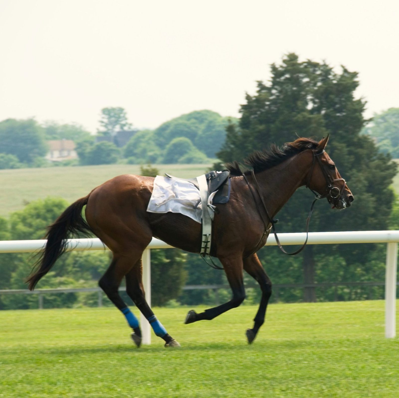
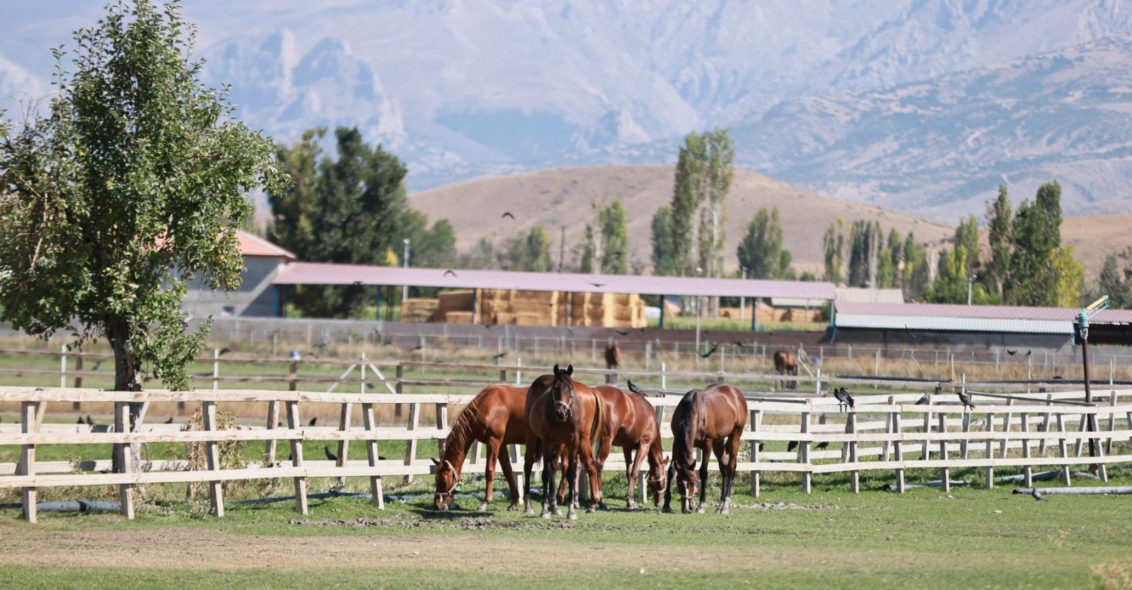
Horse Breeding

Thanks to its abundance of brome grass, calcium-rich soils, and favorable climate, Ereğli has become an important center for thoroughbred horse breeding.

Modern horse boarding and training facilities have been established, making the district an attractive hub for breeders and equestrian enthusiasts.

Geographically Indicated Products

Coğrafi İşaretli Ürünlerimiz

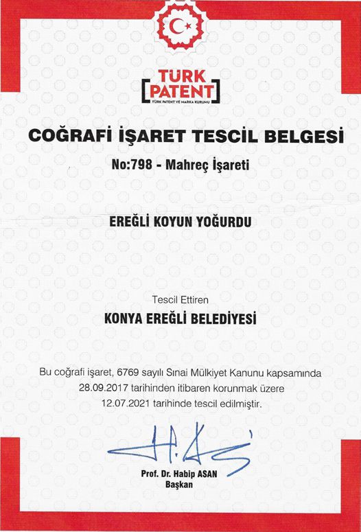
Ereğli Sheep Yogurt

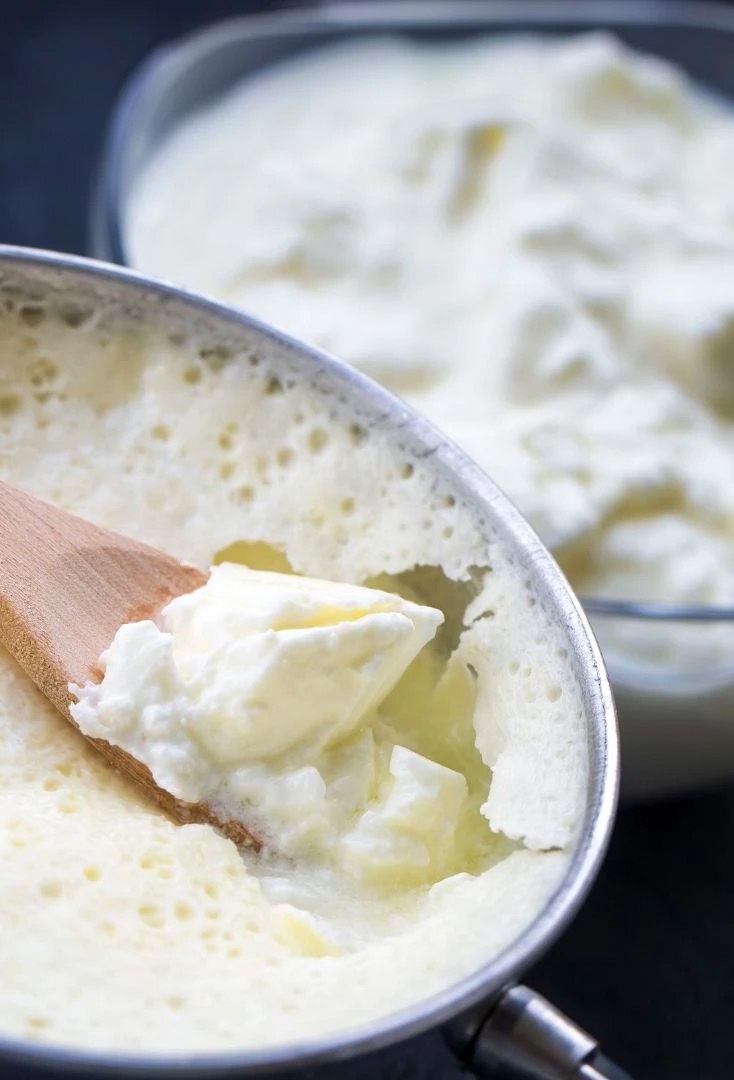
One of Ereğli's oldest traditional products, Ereğli Sheep Yogurt has been produced for centuries. In home production, sheep's milk is heated over a wood fire; in industrial production, it is heated in boilers using natural gas, LPG, or electricity. During heating, the milk surface slightly caramelizes, giving the yogurt its distinctive "smoky aroma." This mild burnt flavor is the hallmark of Ereğli's yogurt tradition.

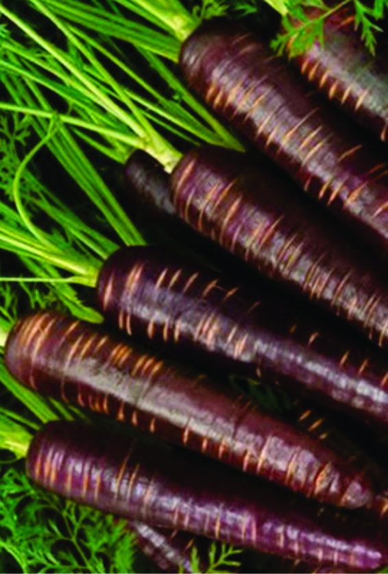
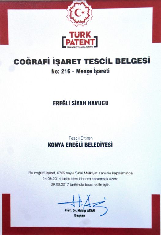
Black Carrot

The cultivation of black carrots began in 1940 in Ereğli, making the district one of Turkey's leading producers. In the domestic market, black carrots are primarily used in fermented turnip juice (şalgam), while more than half of the total production is exported abroad. They are also used as natural food coloring, in cosmetics (body oils), and in the food industry for making jams, ice cream, and juices.

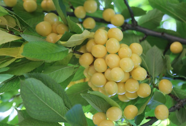
Ereğli White Cherry

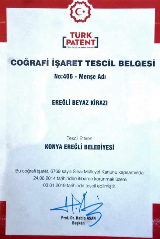
The production of white cherries in Ereğli began in 1902 and constitutes a major livelihood for neighborhoods situated at the foothills of the Taurus Mountains. Almost the entire yield is exported to Europe, primarily Italy. In addition to being consumed as fruit, it is also used in jam, marmalade, cake decoration, and the cosmetics industry.

Ereğli Long Zucchini

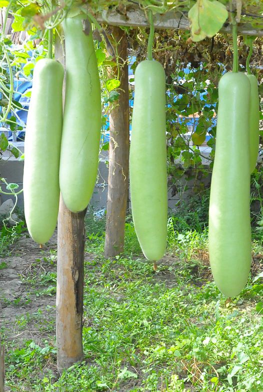
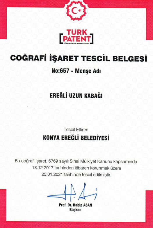
Produced since 1955, the Ereğli Long Zucchini is light green in color, weighing 3–9 kg with a 30–40 cm diameter. At harvest, its length ranges from 50 cm up to 1–1.5 meters. Cultivated through natural methods, it is widely used in traditional dishes as well as modern recipes, appreciated for its mild and unique taste. Grown in Ereğli's fertile soils, this zucchini enriches the region's culinary diversity and contributes to the local economy.

Regional Cuisine

Yöresel Lezzetler

Etli Topalak

Etli Topalak

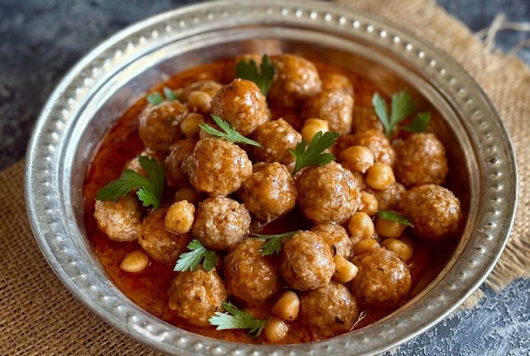
One of the traditional local dishes of our region, Etli Topalak is prepared with small meatballs made from ground meat, fine bulgur, egg, flour, onion, parsley, and spices. The meatballs are combined with chickpeas, tomato paste, butter, and meat broth, creating a distinctive regional dish with a rich flavor and hearty texture.

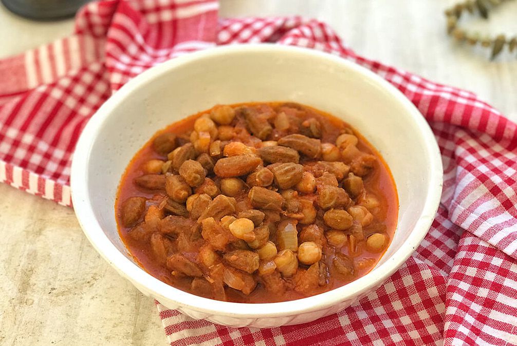
Okra Soup

Okra Soup

A beloved dish of the local cuisine, Okra Soup is prepared with okra, onion, green pepper, tomatoes, and tomato paste. Finished with lemon juice and spices, the soup stands out with its distinctive mildly tangy flavor.

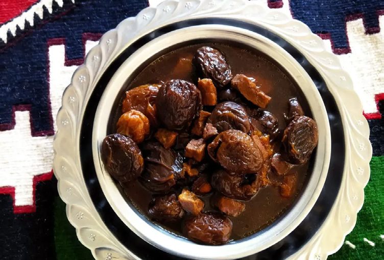
Apricot Dish

Apricot Dish

One of the distinctive dishes of Ereğli cuisine, Kayısılı Yemek combines diced meat, butter, and whole Tokaloğlu apricots. Balanced with a small amount of sugar, the dish brings together the rich flavor of meat and the distinctive sweet-and-sour taste of apricots.

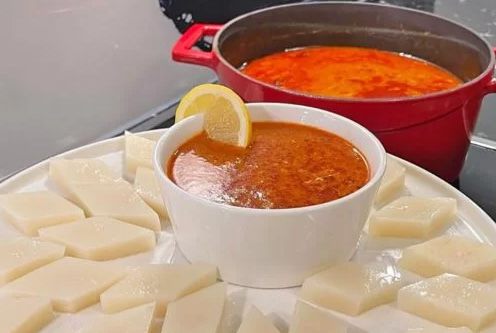
Arabaşı Soup

Arabaşı Soup

A cherished dish of winter tables, Arabaşı Soup is a distinctive soup made with shredded rooster meat, flour, chicken broth, lemon juice, and black pepper. It is traditionally served with a special Arabaşı dough and eaten together with the hot soup. The combination of the warm, flavorful soup and plain dough gives this dish its unique place in the local culinary tradition.

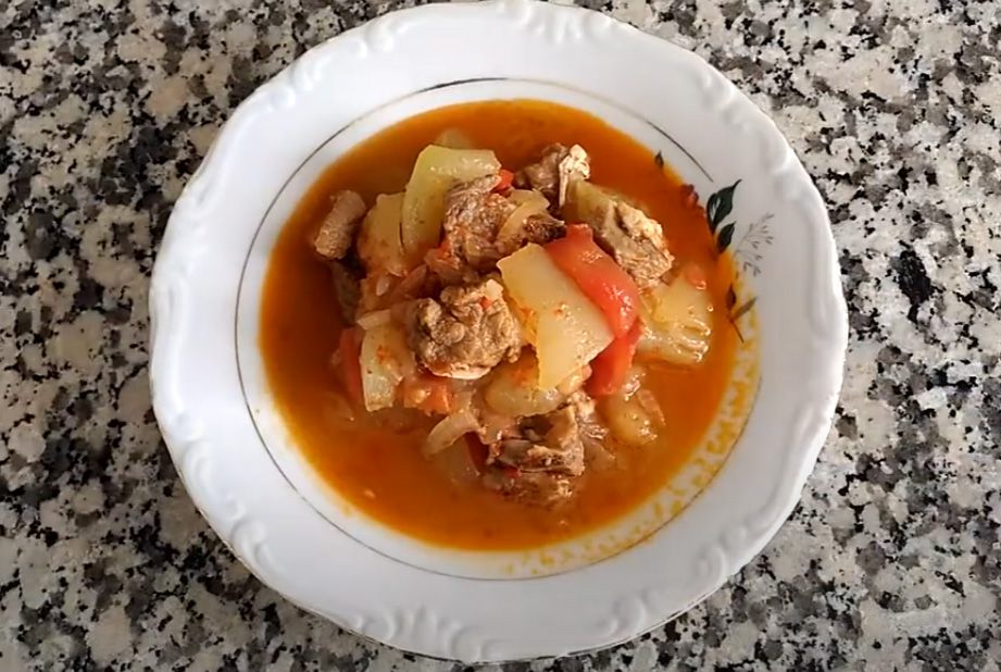
Long Zucchini Dish

Long Zucchini Dish

One of the most distinctive dishes of Ereğli cuisine, Uzun Kabak Yemeği combines long squash with meat, onion, and tomatoes. Seasoned with grape sour sauce, salt, and black pepper, it can be prepared either with meat or with olive oil. The subtle tang of grape sour sauce gives the dish its characteristic flavor.

Etliekmek

Etliekmek

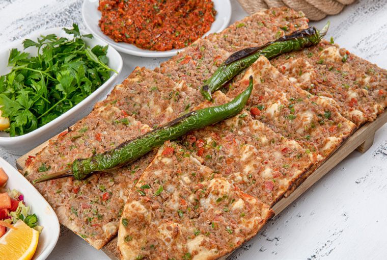
One of the signature flavors of Ereğli cuisine, Etliekmek is prepared by spreading a mixture of lamb, onion, tomatoes, and peppers over thin, elongated dough. Baked in a wood-fired oven on a stone base, Etliekmek is a defining symbol of Ereğli cuisine, known for its crisp dough and distinctive meat topping.

Our Facilities

Tesislerimiz

All facilities (25)

The History and Culture Guide

Download the guide PDF · 9,9 MB